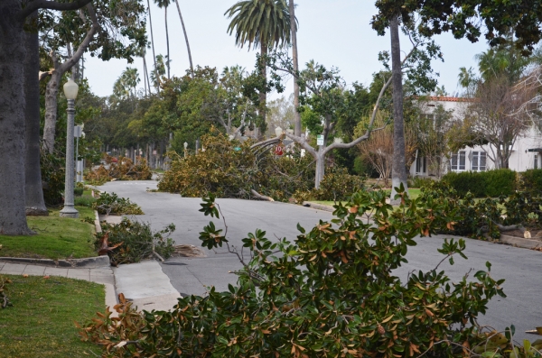
Southern California experienced unusually strong winds of up to 70 mph on Sunday, taking out power for over 140,000 homes and taking the life of a driver who was crushed by a falling tree.
Gusts of wind topped 50 mph in San Diego, 65 mph in Malibu, and 115 mph in Whitaker Peak, according to the National Weather Service.
Several roads were blocked off by fallen trees, power lines, and large signs. One of these roads include the Interstate 5 leading in and out of northern Los Angeles County, which was briefly shut before dawn because of the icy road conditions, according to the California Highway Patrol.
Fire-Rescue Captain Joe Amador said an 80-foot-tall tree fell on a car, killing a driver in San Diego. The tree had a diameter of about 6 feet and had crashed onto three parked cars along with the fourth car that was passing by, driven by the woman who was declared dead by the authorities.
San Diego generally received a total of less than an inch of rain, but areas at higher elevations saw significantly more. Stephen Harrison, a meteorologist with the National Weather Service said that the San Bernardino Mountains saw five inches of rain.
A flash flood watch was issued for foothill neighborhoods underneath wildfire burn areas, where the rain triggered fear of mudslides and debris flows of rocks and branches that had recently burned.
All Rim of the World Unified School District schools will be closed today due to the icy road conditions as well as schools in Bear Valley Unified School District due to wind and snow conditions. Such areas of elevation are predicted to receive several inches of snow on Monday, February 1.
In his blog post on the California Weather Blog, Daniel Swain, a Stanford climate scientist, states that this tropical storm developed unusually close to California, but this pattern is seeming to be more common "during strong El Nino years."
The National Weather Service stated that the rain forecast was to clear up early Monday, while the powerful winds and dangerous surf is expected to diminish by evening, as the storm slides east toward Arizona.


